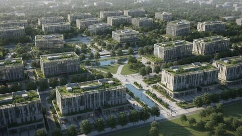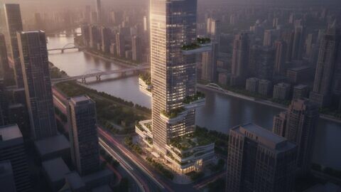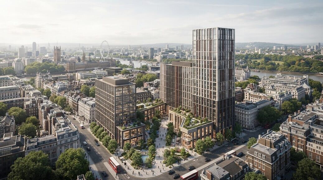
An aerial view can make a development look compelling and still leave the questions that matter unanswered: how it meets the street, relates to neighbouring buildings and sits within the wider landscape. Aerial cgi is persuasive when the surrounding context is as legible as the proposed scheme.
Choosing the right viewpoint isn’t simply a matter of showing more of the site. A high bird’s-eye view may explain layout and connections, whilst a lower oblique angle can make building form and its relationship to nearby streets easier to read. The wrong choice can obscure design intent or make the setting feel misleading. Aerial CGI also serves a different purpose from ground-level renders, maps and photography, so each format should be selected for the question it needs to answer.
This article explains how to match an aerial visual approach to your project objective, communicate context with architectural precision and brief a CGI studio effectively. You’ll learn what source information can support accurate site representation, how to assess viewpoint and level of detail, and how aerial CGI can work alongside other project imagery. The result is a clearer basis for presenting the proposal to stakeholders, without asking one image to do every job.
Key Takeaways
- Match the aerial CGI viewpoint to the decision your image needs to support, rather than choosing an angle for visual impact alone.
- Compare aerial CGI with ground-level renders, aerial photography and interactive experiences to select the format that communicates your project most clearly.
- Assess whether the image represents the development, access routes, landscape and neighbouring context with architectural precision.
- Prepare current drawings, BIM information, site references and agreed design details to give your CGI studio a clear, practical brief.
- Coordinate aerial views with interior renders, exterior imagery and animation to build a coherent visual story for your project.
What aerial CGI shows, and why the viewpoint matters
Aerial CGI is a computer-generated view of a proposed development from an elevated perspective, composed to explain how the scheme relates to its site and surroundings. The viewpoint is a communication choice, not just a stylistic one. A carefully framed image can bring buildings, landscape, access routes and neighbouring context into one legible composition, helping viewers understand the overall arrangement before examining individual façades.
It differs from an aerial photograph, which records existing conditions, and from a simple map, which prioritises locations, boundaries or routes through graphic symbols. A CGI view can depict a proposed design within a represented setting; its accuracy depends on the design information and context used to create it. Architectural rendering includes aerial views among the approaches used to communicate a design, but the chosen format should always serve a defined project objective.
What can an aerial view communicate about a development?
Framing determines what the viewer can compare. A higher viewpoint may clarify the site’s overall form and connections, whilst a lower, oblique angle can give more emphasis to building height and the relationship between the proposal and nearby streets. Including landscape features, access routes and surrounding buildings can help orient viewers, provided these elements are shown in proportion and do not compete with the scheme.
Clarity depends on fidelity as well as composition. The proposed massing, layout and agreed design details should align with the source information, while the setting should support the intended narrative rather than imply unverified changes. A polished image that obscures these distinctions can create uncertainty instead of visual authority.
When does aerial CGI add value to a project story?
Aerial CGI is particularly useful when stakeholders need to understand the development as part of a wider site: how buildings sit together, where access meets the scheme, or how landscape and neighbouring context frame the proposal. It gives a broad spatial reading, not the close inspection of materials, entrances or façade details that a ground-level view can provide. Use the aerial image to explain relationships; pair it with closer views when architectural character is central to the discussion.
This objective-led approach is part of effective architectural rendering. Select the view according to the decision or conversation it must support, then coordinate it with other imagery so each visual contributes a distinct, consistent part of the project story.
Aerial CGI compared with other architectural views
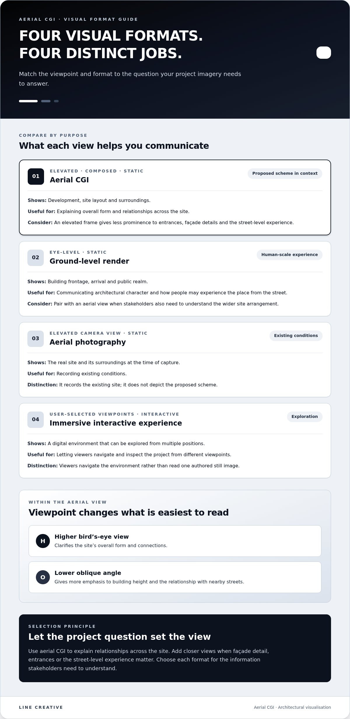
Each visual format answers a different question. Aerial CGI gives stakeholders a composed overview of the site, but its elevated viewpoint can reduce the prominence of entrances, façade detail and the experience at street level. Choose the format around the audience and message, then combine views where the project needs both spatial context and human-scale clarity.
| Format | Viewpoint | Context conveyed | Interaction | Typical purpose |
|---|---|---|---|---|
| Aerial CGI | Elevated, composed view | Development, site layout and surroundings | Static | Explain overall form and site relationships |
| Ground-level render | Eye-level or near eye-level | Building frontage, arrival and public realm | Static | Communicate architectural character and human-scale experience |
| Aerial photography | Elevated camera view | Existing site and surroundings at the time of capture | Static | Record real-world conditions, not the proposed scheme |
| Interactive experience | User-selected viewpoints | Context explored from multiple positions | Interactive | Let viewers navigate and inspect a digital environment |
Aerial CGI or ground-level architectural renders?
Use an aerial view when the decision depends on the relationship between buildings, access and the wider site. Use ground-level renders to explain how people may approach an entrance, experience a public space or read a façade from the street. Neither is inherently superior. Aerial CGI can establish the overall composition; closer views can then reveal architectural detail that the elevated frame cannot carry clearly.
This pairing also helps manage interpretation: the overview communicates spatial organisation, whilst eye-level imagery gives scale and a more immediate sense of place. The right balance depends on what stakeholders need to understand.
Aerial CGI or an immersive interactive experience?
A still aerial view directs attention through a deliberate composition. By contrast, immersive interactive experiences are digital assets that combine real-time engines and user interaction, allowing stakeholders to explore a project from different viewpoints. They can support questions that a single frame cannot answer, though they require viewers to navigate the environment rather than read one authored image.
For a project that calls for interactive exploration, see Line Creative’s virtual production and immersive experiences. A coordinated set of stills and interactive content can serve different audiences and stages of a project story.
How to brief and assess aerial CGI for your project
A useful brief starts with the communication task, not the camera angle. Define who needs to understand the proposal, what they need to take away, then select a viewpoint that makes that information clear. This sequence helps prevent an attractive composition from obscuring the scheme’s purpose.
What should an aerial CGI brief establish?
State whether the visual supports planning, investment or marketing communication, and identify the aspects of the proposal that matter to that audience. For example, stakeholders may need to read the building arrangement and access, whilst a marketing audience may need a stronger sense of setting and overall character. Be specific about what the frame must explain.
Provide the CGI studio with the most relevant project information available, such as:
- Current drawings and BIM information that represent the agreed design.
- Site references that help establish existing buildings, landscape and access.
- Agreed design details, including any elements that remain subject to change.
- Direction on viewpoint, atmosphere, key areas of emphasis and intended narrative.
- Technical specifications suited to the final image’s channels and use.
Keep the distinction between confirmed design information and elements still under review clear. This gives the studio a sound basis for architectural precision and reduces the risk of the image implying details that the project team hasn’t agreed.
How can you assess the visual before approval?
Review the composition against the brief. Can the intended audience understand the scheme’s scale, access and relationship to its setting? Does the camera angle reveal the information required, or does it hide key connections? Check that surrounding context supports orientation without drawing attention away from the proposal.
Then compare visible design features with the supplied drawings, BIM information and agreed details. Look for inconsistencies in building form, layout or site relationships, as well as any contextual additions that could suggest unsupported project changes. Finally, assess legibility at the size and in the format in which the image will be used. A detailed render still needs to communicate clearly in its final setting.
For examples of architectural visual communication, explore the Line Creative portfolio. Use these principles to brief aerial CGI around a defined audience, accurate source information and a clear project objective.
Aerial CGI as a strategic asset for high-stakes projects
Aerial CGI is most valuable when its viewpoint serves a defined project decision. For planning, investment or marketing discussions, the image can help stakeholders read the proposal’s overall arrangement and relationship to its setting. It can strengthen understanding, but it cannot guarantee planning approval, investment or sales. Its value rests on clear visual communication, accurate design representation and a narrative suited to its audience.
Build a coherent visual story around the aerial view
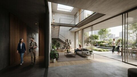
Place the aerial view within a coordinated sequence, rather than treating it as a standalone image. It can establish the site-wide picture; exterior renders can communicate architectural character and street-level experience, interior views can describe spaces, and animation can convey movement or sequence. Each asset should express the same agreed design intent, material language and project narrative. Consistency across views supports visual authority and reduces the risk of stakeholders receiving conflicting impressions.
For a scheme with several uses, the story should make the relationships between those uses clear without overloading the aerial frame. Select which connections the overview needs to explain, then use closer views or other project materials to provide detail. The visual sequence should guide understanding, not ask one image to answer every question.
Choose a strategic CGI partner, not just a viewpoint
A strong CGI architectural visualisation process brings creative direction together with architectural precision and technical production. The studio should shape the composition around the project objective, maintain alignment with the supplied design information and consider how the image will function in its intended setting. That is a strategic partnership: the work is guided by communication needs, not simply by the production of an attractive frame.
Line Creative is an award‑winning CGI studio, with multiple CGarchitect Awards and work with Zaha Hadid Architects, Olson Kundig and Aman Resorts. This experience informs a story-led approach to architectural visual communication, whilst each project’s visual direction remains specific to its design and audience. The aim is a clear, considered representation, not a promised commercial or planning outcome.
If you’re ready to shape a visual approach around your project’s objectives, discuss your project with Line Creative.
Make the next view count
Aerial CGI earns its place when the viewpoint makes the proposal and its setting easier to understand. Choose the image format around the audience and decision, then pair the overview with ground-level, interior or animated visuals where stakeholders need more detail. A focused brief, accurate source information and careful review help keep the final image aligned with the agreed design intent.
For high-stakes development communication, visual quality must be matched by architectural precision and a coherent project story. Line Creative’s recognition includes multiple CGarchitect Awards and an SME UK Award, alongside experience working with Zaha Hadid Architects, Olson Kundig and Aman Resorts. These credentials inform a considered approach to architectural visualisation, without promising planning or commercial outcomes.
Give your proposal a clear visual direction. Discuss your project with Line Creative and take the next step towards imagery shaped around your objectives.
Frequently Asked Questions
What is aerial CGI in architectural visualisation?
Aerial CGI is a computer-generated view of a proposed development from an elevated viewpoint. It places the scheme within a visual representation of its site, helping viewers read building arrangement, landscape, access and surrounding context together. The camera angle and framing are selected to serve the project’s communication objective. Unlike a map, the image can show architectural form and atmosphere; unlike a photograph, it can depict a proposal that has not yet been built.
When should a development use aerial CGI?
Use aerial CGI when stakeholders need to understand how a proposal relates to its wider site. It can clarify the arrangement of buildings, connections between different areas, access routes and the relationship to nearby context. It is particularly useful when a ground-level view cannot communicate the overall composition. For façade character, entrance design or the public realm at eye level, pair the overview with closer architectural renders rather than relying on one viewpoint alone.
Is aerial CGI the same as an aerial photograph?
No. An aerial photograph records existing conditions from an elevated camera position, whilst aerial CGI is generated from a 3D representation and can depict a proposed development within its setting. Photography can help establish the real site context; CGI communicates design intent before construction. The two approaches serve different purposes, and any computer-generated context should be based on suitable site references and agreed project information to avoid implying changes that are not part of the proposal.
Can aerial CGI be used for planning approval?
Aerial CGI can support planning communication by making a development’s scale, layout and relationship to its setting easier to understand. Its usefulness depends on whether the viewpoint addresses the questions relevant to the proposal and accurately reflects agreed design information. It is a visual communication asset, not a guarantee of planning approval. Keep the image consistent with the project material it accompanies, and avoid presenting unagreed or illustrative details as confirmed design.
What information is needed to create aerial CGI?
Useful source material includes current architectural drawings, BIM information where available, site references and agreed design details. The brief should also identify the intended audience, the communication objective and which elements of the scheme and context need to be legible. Share clear distinctions between settled design information and items still under review. Technical specifications should reflect where and how the final visual will be used, so its format and level of detail suit that purpose.
How is aerial CGI different from an architectural walkthrough?
Aerial CGI usually presents a fixed, elevated composition designed to communicate the site-wide arrangement at a glance. An architectural walkthrough instead follows a route through or around the proposed environment, using moving views to convey sequence, arrival and spatial experience. A walkthrough may be delivered as animation or as an interactive experience, depending on the project. Use the aerial view for orientation and the walkthrough when viewers need to understand how spaces unfold from one viewpoint to another.